P.E.T.O.T Samaná
Península de Samaná, República Dominicana. 2017-Actualidad
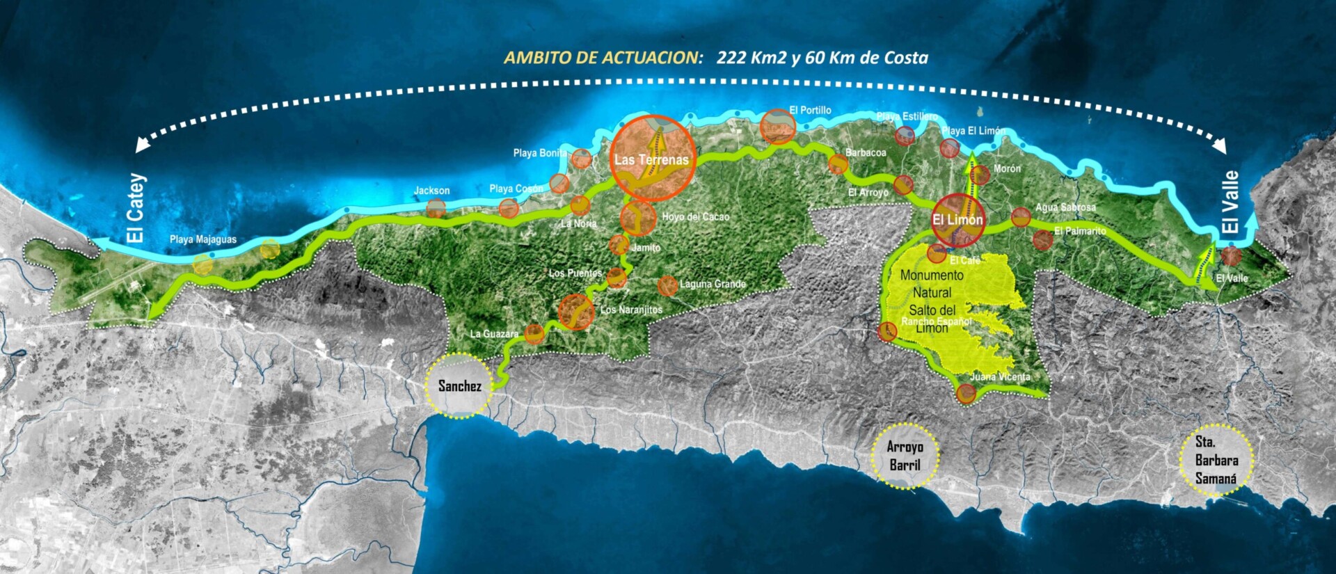
El Plan Estratégico Territorial y de Ordenamiento Turístico (P.E.T.O.T.) de Samaná, es una herramienta urbanística elaborada con el fin de transformar 222 km² al norte de la península de Samaná en un nuevo referente con identidad propia, haciendo que, a nivel nacional, el ámbito a desarrollar se reconozca como un lugar de encuentro, y desde el contexto internacional, se convierta en un nuevo destino.
En la FASE 1 se establecieron las tres líneas de acción base de toda la estrategia:
– Lograr de Samaná un territorio conectado, con un eje litoral que priorice al peatón.
– Un territorio diversificado, en donde al turismo de sol y playa se le sume una amplia oferta de acceso al paisaje de montaña.
– Un territorio mancomunado, dotado de un completo sistema de equipamientos.
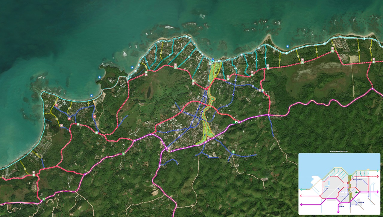
A continuación, y desde las diversas escalas de aproximación, la FASE 2 establece una propuesta de modelo territorial y turístico, basada en la protección y mejora de los recursos naturales y el paisaje, con una estructura vial y movilidad sostenible que mejore la accesibilidad global del ámbito y la ubicación preferente de aquellos equipamientos locales y estructurantes que ayudarían a mejorar la calidad de vida tanto de la población residente como de los visitantes.
- Lugar/Fecha: Península de Samaná, República Dominicana / 2017-Actualidad
- Cliente: Ministerio Administrativo de la Presidencia de República Dominicana
- Arquitectos: luis vidal + arquitectos
- Superficie: 22.200 ha
- Estado: En desarrollo
- Equipo: Constanza Andrade – Carmen Andújar – Leidy Delgado – Itziar de Francisco – Zainab Ibrahim – Pedro de Lachiondo – Rafael Meana – Paloma Montero – Alejandro Nieto – Eugenia Porras – Johanna Rodríguez – Patricia Rojas – Leslie Salomón – Fernando Sánchez – Gonzalo Sánchez – Cristina Sánchez – Óscar Torrejón – Luis Vidal – URBE